

November 27, 2025
Hydraulic and agricultural transformations in Doñana
The hydraulic and agricultural evolution of Doñana since the 19th century constitutes a paradigmatic example of how human interventions can profoundly alter the functioning of a complex ecological system.
A history of ecological disconnection
Over two centuries, actions on the Guadalquivir River, the Guadiamar River, and the marsh itself have pursued productive objectives—mainly agricultural—that have increasingly conflicted with the conservation of the natural space.
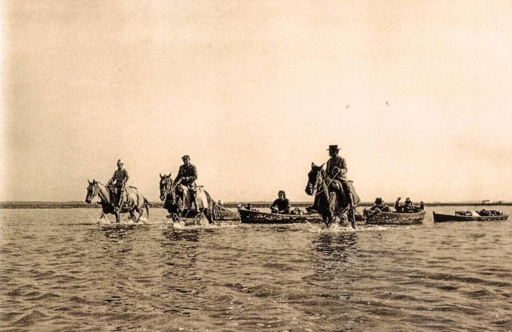
One of the first milestones was the cutting of the Brazo de la Torre canal in 1815, which modified the course of the Guadalquivir, preventing it from flowing through the marsh as it originally did. This change significantly reduced the natural water inputs during winter floods, altering the hydroperiod that sustained the biodiversity of the system.
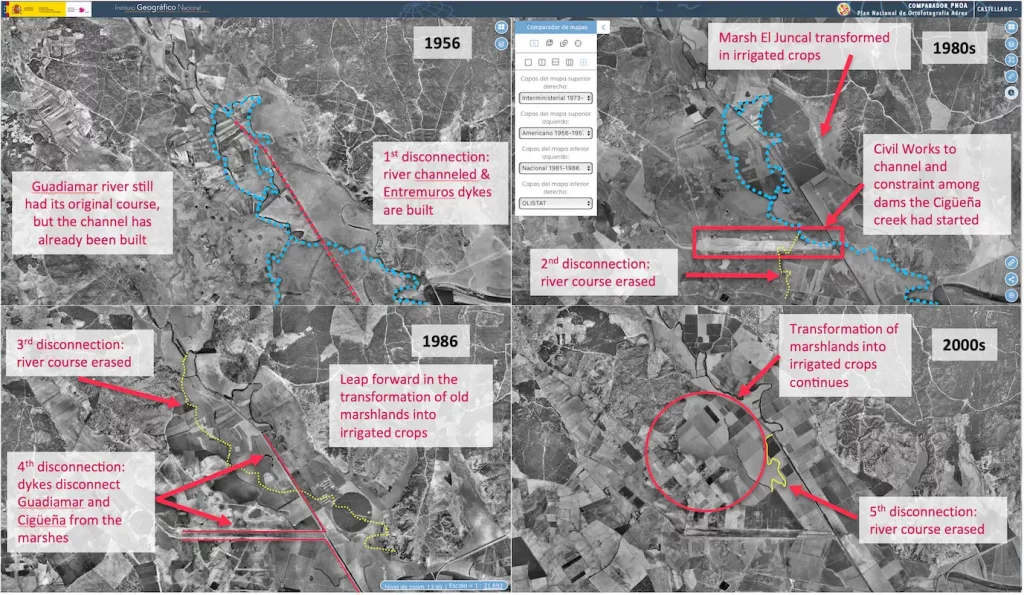
The process intensified in the 20th century with the construction of the Entremuros dam in 1955, which allowed for the drainage and cultivation of approximately 15,000 hectares. This infrastructure consolidated the agricultural transformation of the territory, but at the same time, it fragmented the hydrological system, limiting the connectivity between the river and the marshland.
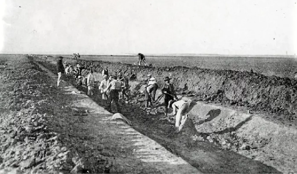
Subsequently, the construction of the so-called “FAO Wall” and the channelling of streams such as the Cigüeña stream reinforced this disconnection. In parallel, during the 1970s and 1980s, partial restoration projects were undertaken—such as the restoration of channels or the artificial flooding of certain areas—which already demonstrated a growing awareness of the ecological deterioration of the system.
A key turning point occurred in 1984 with the reconstruction of the natural dam on the Guadalquivir River, known as the “Montaña del Río” (River Mountain). This intervention aimed to isolate the marsh from the tides and control the inflow of saltwater, but it had significant side effects: it hindered natural drainage and altered flooding patterns, leading to water accumulation and silting in certain areas.
In 1998, following the Aznalcóllar mining disaster, the dike system was further reinforced to prevent the entry of pollutants, increasing hydraulic isolation. From that moment on, the marshland practically lost the direct influence of the Guadalquivir River’s floods and became dependent on local water sources and artificial water management.
Subsequent interventions, such as the Doñana 2005 project and the 2014 Entremuros flood control project, attempt to partially reverse this situation. However, these actions are implemented with a cautious and controlled approach, allowing water to enter only under specific conditions (for example, flow rates exceeding 10 m³/s), which limits their effectiveness in ecological terms.
In parallel, intensive agricultural development and groundwater extraction have led to a drop in the water table and the disappearance of natural springs, exacerbating hydrological disconnection and increasing the system’s vulnerability to droughts.
The result is a profoundly transformed territory, where productive objectives—irrigation, flood control, infrastructure—have historically taken precedence over ecological functionality. The current challenge lies in reconciling both approaches, restoring natural processes as much as possible without compromising existing socioeconomic uses. This balance is at the heart of the contemporary debate on the future of Doñana.